Lot 145
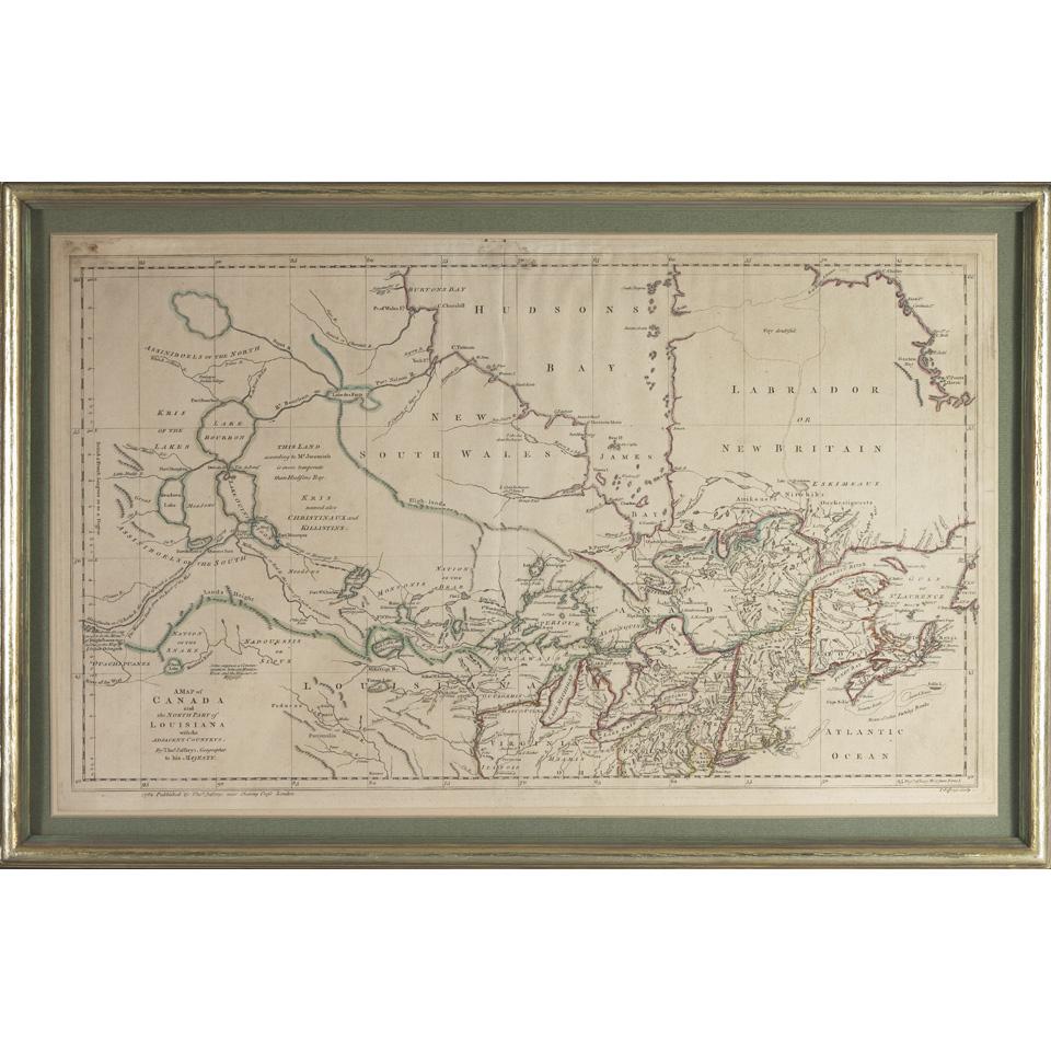
Thomas Jefferys (18th Century)
Lot 145 Details
Thomas Jefferys (18th Century), British
A MAP OF CANADA AND NORTH PART OF LOUISIANA WITH THE ADJACENT COUNTRYS
Handcoloured engraving; published in London in 1762
Together with:
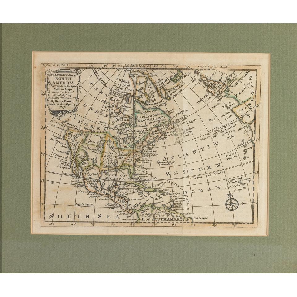
Emanuel Bowen (fl. 1714-1767), British, AN ACCURATE MAP OF NORTH AMERICA DRAWN FROM THE BEST MODERN MAPS AND CHARTS AND REGULATED BY ASTRON: OBSERVAT, Handcoloured engraving; dated 1747 with much of Canada titled as “Parts Undiscovered” and Native American territories in the midwest of the USA and Canada as “New Britain”
Plate 6" x 8" — 15.2 x 20.3 cm.
Together with:
Eleazer Huntington (17th/18th Century), American, NORTH AMERICA, Handcoloured engraving; published by H. & F.J. Huntington, Connecticut in 1830, Plate 9.5" x 12" — 24.1 x 30.5 cm.
Sight 13" x 21.5" — 33 x 54.6 cm.
Estimate $300-$500