Lot 525
Thomas Jefferys (British, c.1719-1771)
Lot 525 Details
Thomas Jefferys (British, c.1719-1771)
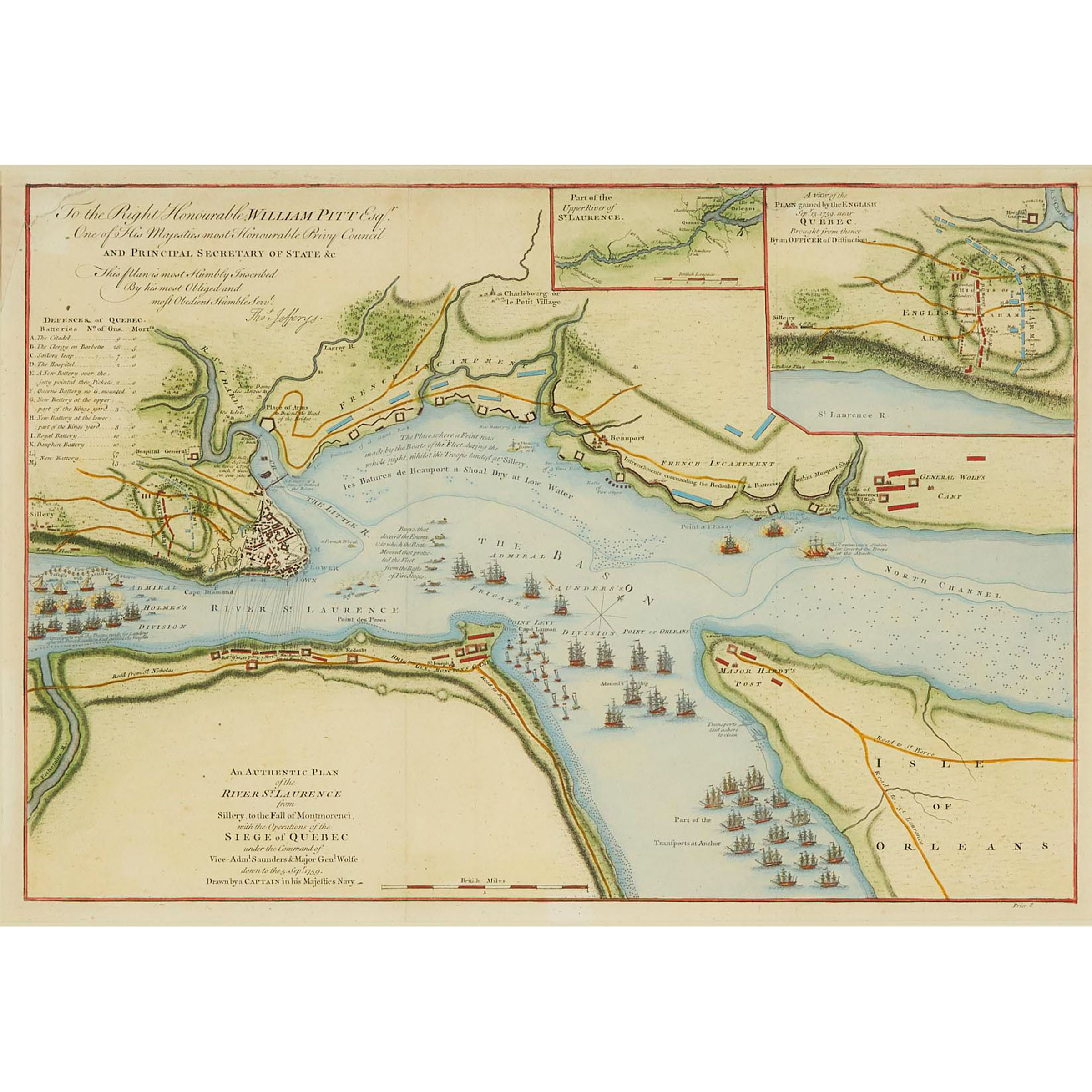
THE SIEGE OF QUEBEC
hand coloured engraved topographic map detailing the 1759 Siege of Quebec (Battle of the Plains of Abraham) including positions of the British and French fleets, the placement of batteries on both sides of the St. Lawrence, the bombardment of Quebec and a key noting positions of the Defenses of Quebec
sight 13.25 x 19.75 in — 33.7 x 50.2 cm; sight 23.25 x 28.75 in — 59.1 x 73 cm
Estimate $200-$300
Additional Images
Note:
The current lot is one of the first maps of the area to be printed in London following the news of the British victory on the Plains of Abraham and widely considered to be the most authoritative contemporary pictorial depiction of the series of events leading up to the battle, and the most important printed map in Canadian history.