The Canada Auction Series: Canadian Arts, Culture & History

May 27June 01, 2023
Auction begins to close at 6:00 pm ET

Online Auction
LOT 373

Lot 373

Two Small Maps of Canada, early-mid 18th century

Two Small Maps of Canada, early-mid 18th century
Lot 373 Details
Two Small Maps of Canada, early-mid 18th century

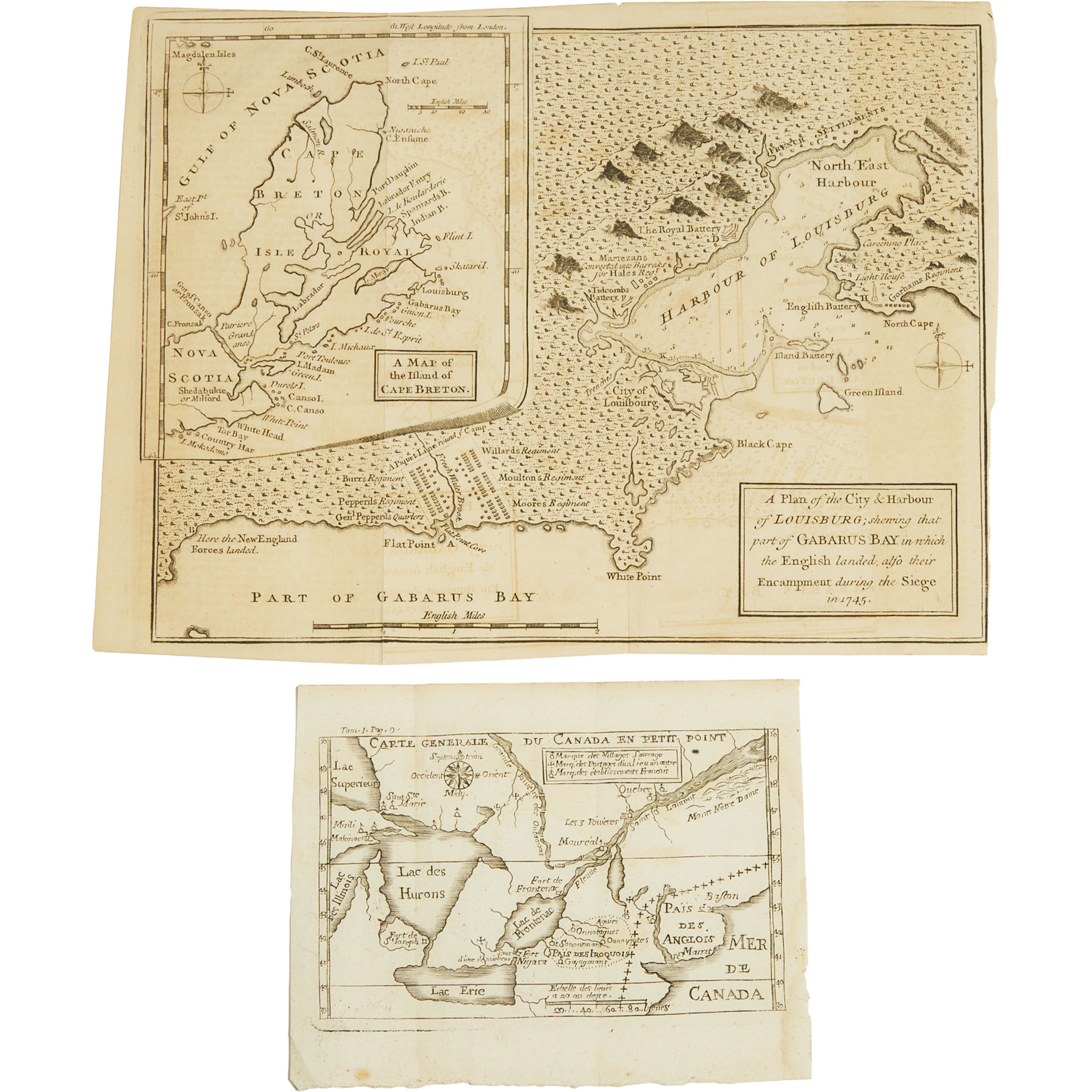
CARTE GENERALE DU CANADA EN PETIT POINT (1703), AND A PLAN OF THE CITY & HARBOUR OF LOUISBURG: SHOWING THAT PART OF GABARUS BAY IN WHICH THE ENGLISH LANDED, ALSO THEIR ENCAMPMENT DURING THE SIEGE IN 1745

the first by Louis-Armand de Lom d'Arce de Lahontan, Baron de Lahontan (1666-prior to 1716), the second published in Gentlemen's Magazine, March 1758
Carte Generale 4.75 x 6 in — 12.1 x 15.2 cm; Louisburg 8 x 10.5 in — 20.3 x 26.7 cm

Estimate $250-$350

Realised: $123
Price Includes Buyer's Premium ?

Lot Report

Read More About This Lot:

About Baron de Lahontan

CONDITION DETAILS

Both in substantially good condition.

LOT 373
×

About Condition Ratings

  • 5 Stars: Excellent - No discernable damage, flaws or imperfections
  • 4 Stars: Very Good - Minor flaws or imperfections visible only under close inspection using specialised instruments or black light
  • 3 Stars: Good - Minor flaws visible upon inspection under standard lighting
  • 2 Stars: Fair - Exhibits flaws or damage that may draw the eye under standard lighting
  • 1 Star: Poor - Flaws or damage immediately apparent under standard lighting (examples: missing components, rips, broken glass, damaged surfaces, etc.)

Note: Condition ratings and condition details are the subjective opinions of our specialists and should be used as a guide only. Waddington’s uses due care when preparing condition details, however, our staff are not professional restorers or conservators. Condition details and reports are not warranties and each lot is sold “as is” in accordance with the buyer’s terms and conditions of sale. In all cases the prospective purchaser is responsible for inspecting the property themselves prior to placing a bid.